Showing posts with label Virginia 2014. Show all posts

Friday, April 11, 2014

Skyline Drive

After staying two nights with our friends in Charlottesville, we drove home via the Skyline Drive. If you know your American geography, you would know about the Appalachian Mountains that run up the east coast. Like the Great Dividing Range in Australia, they are very old mountains that once were much higher.

The Skyline Drive was built along ridges near the tops of the mountains and extends for 105 miles in Virginia. We drove the 65 mile section from Route 33 to Front Royal.


Much of the drive lies between 2000 and 3500 feet high so there are plenty of places where you can stop your car, get out and take in a view of the Shenandoah Valley to the west.


Trucks are not allowed on the road and consequently, the road surface is lovely to drive on. There are lots and lots of curves and the speed limit is 35 mph so progress is slow if you stop to look at the views.


We were fortunate that it had rained two days prior and the air is relatively clear and clean.


Snow on a mountain top in the distance.


You can see the white of the snow on the far left.


Even though the air was clean, there is still quite a lot of haze even for this view to the west. The views to the east were limited because of the morning sun shining through the haze.


Because of the long winter, all the deciduous trees were without their leaves. not many even had buds. Many people do the drive in Fall (Autumn) to see the leaves in colour.


We stopped at a Vistors Center that had a display about the young men who built the road back between 1933 and 1942. It was one of the ways President Roosevelt dealt with the huge unemployment during the Depression. Marianne's step-father was Part of the CCC when he was a young man, but he did not work on this project.


The view today.


The  view at the dedication.


The road became very popular. Fortunately we were not driving this road in summer so there was very little traffic. Incidently, admission was free for us because I showed my National Parks Seniors Card. If you live in the USA and are over 62, your should get one of these cards for $10 and keep it in your wallet. It's good for life or until you lose the card.


It was a great idea and this National Park was the first on the east coast of the US.


Hawksbill Mountain, the highest point at 4050 feet.


The views are best when there are no leaves. At other times of year, the views are much more limited.


Leaving one of the view points.


Towards the end of the drive, the clouds rolled in and the mist became more pronounced.


Even so, it is still very beautiful.


One of the branches of the Shenandoah River.


A farm in a pool of sunshine.


As we reached the Visitors Center near Front Royal, a group of hikers appeared. I immediately felt some camaraderie with them after my experiences hiking the Grand Canyon and the Wainwright walk across England. Oddly enough, I have no desire to walk the Appalachian Trail. As Bill Bryson says in his book, it is a Walk in the Woods. There is too much vegetation and the views are obscured too much by the mist.

The 65 mile drive took about three hours. I really enjoyed the drive but I would have to say that I would only want to do it once every 10 years.


Wednesday, April 9, 2014

Monticello

Perhaps the most famous house in America after the White House is Monticello, built by Thomas Jefferson. It is featured on one side of the nickel (5 cents) coin. Our friend Jean lives in nearby Charlottesville, VA.


The famous view of the house.


Two distinguished gentlemen (centre and right). The gentlemanly status of the one on the left is in doubt. Jefferson was 6'2" tall so I suspect the statue is not tall enough since I am 6'0".


The entrance for tourists and visitors. The dome is not visible from this side.


We had to wait for about an hour for our tour of the building to commence so we walked around the gardens.


The ice house.


This was known as the 'dependency' where much of the work was done by slaves.


Where the washing was done.


A few flowers were blooming but not many after the long cold winter. All the garden beds were covered by netting to keep the rabbits out.


It would not surprise me if Jefferson planted this tree.


The hoops held up the netting.


The grounds are very pleasant without being ostentatious.


Jefferson was very keen on gardening and growing crops. He created a 1000 foot long area for growing all sorts of crops.


The house sits on top of a hill but there is an even higher hill behind it.


No doubt it would be pleasant to walk under this trellis when it was covered in vines. After the long cold winter, there was no evidence of much growing at all.


Even the nursery was barren.


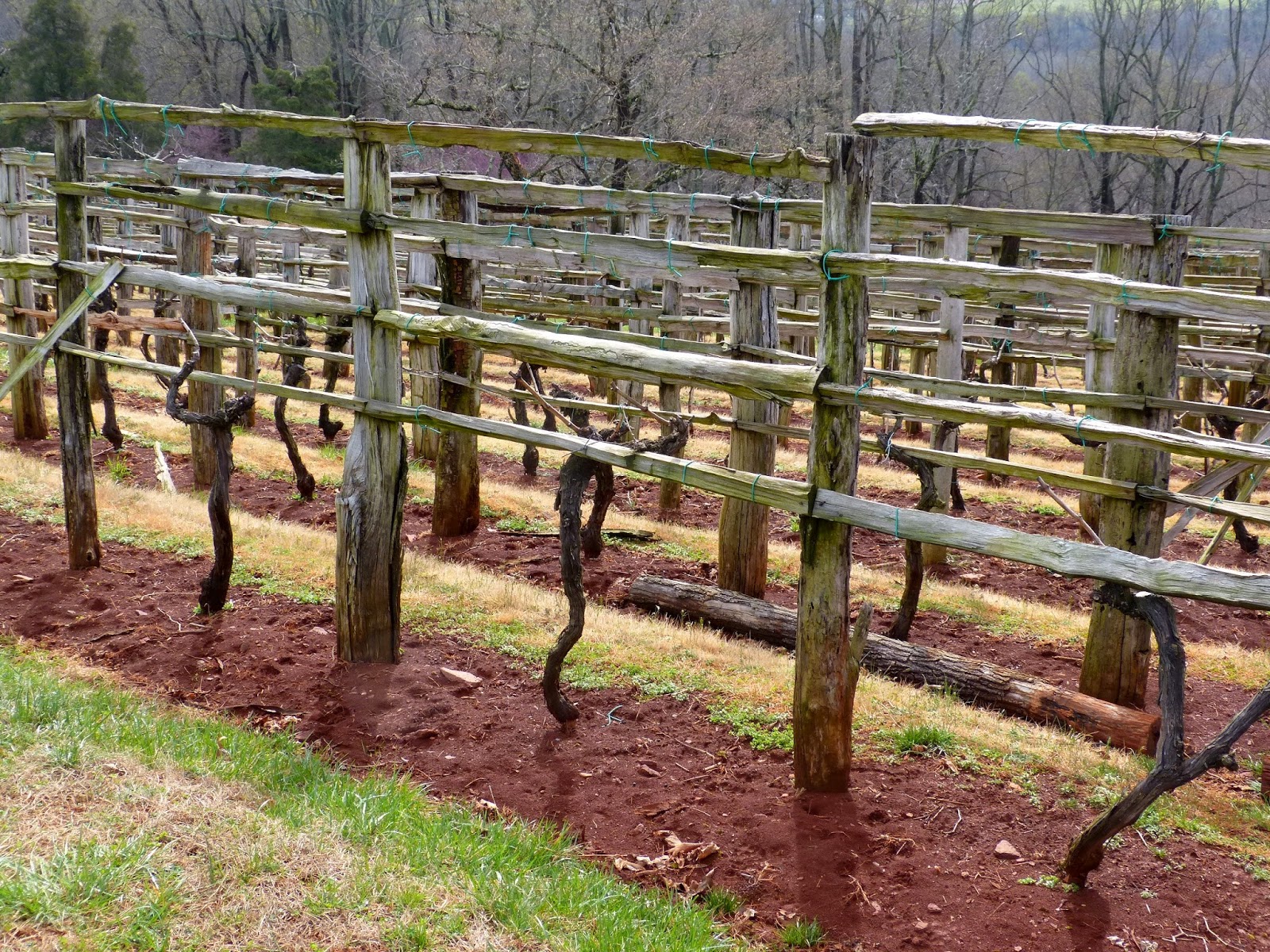
Jefferson was keen on wine and grew his own.


No doubt slaves built this wall.


Peach trees.


Eventually, it was time for our tour to start. Photography inside the house is not allowed.


Paint peeling on the front window sill. I hope our entrance fees ($25) help to get this repainted.


Above the entrance is a weather vane linked to this arrow showing what way the wind was blowing. 

Photography is not allowed in the house, so no photos.

The tour was worth doing, but I got the feeling that everything is timed so that they can push as many people through as possible. Some of the rooms are small so that restricts the size of every group. 


Side view of the house. It really is a fascinating design including octagonal rooms and interesting colours. I could live there.


After the tour, we walked down to Jefferson's grave.


Gate to the graveyard.


His gravestone. Several people are buried underneath as well as Jefferson. 


There are quite a few graves in addition to those in the immediate area of Jefferson's monument.


We took the shuttle bus back to the visitor's center to go though a small museum that showed replicas of items in the house. I happened to look closely at the map and noticed an error in this map. The town of Kemi should be on the western coast. It is in Finland, not Russia. Take note Thomas Kitchin. Perhaps he was one of those craftsman who always put in a mistake since only God makes no mistakes.


How does eagle eyed Ray know this? In less than a month, I will take a train from Kemi to Helsinki on my way to Singapore.

An update to this story. I was wrong in that there is a town called Kem where Kitchin said it should be. I owe that man an apology. OK, he added an 'i'.


View Larger Map


Floor plan of the house.


How the dome was constructed.

It never ceases to amaze me that two such great talents such as Jefferson and Ben Franklin were around at the same time. Add in George Washington and you really had some real talent forming the future of the development of the early USA.